



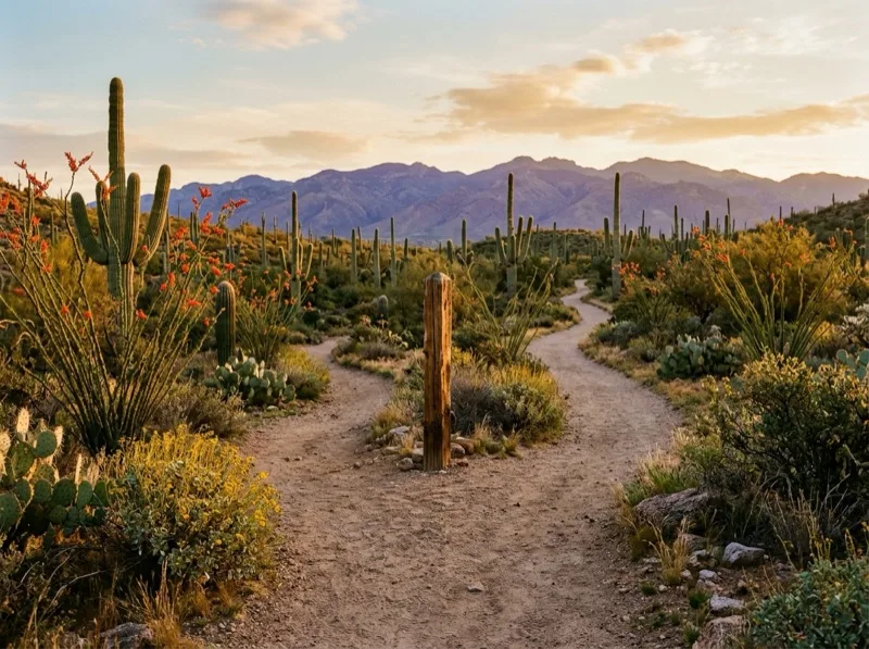
Hiking trail · out and back
AZT CONNECTOR from Marshall Gulch to junction with ORACLE RIDGE

About AZT CONNECTOR from Marshall Gulch to junction with ORACLE RIDGE
3.8-mile out-and-back trail from Marshall Gulch in Coronado National Forest, climbing 580 ft between 7,443 and 7,896 ft max grade 9%. No trailhead parking or entry fee. The trailhead lies near Catalina Foothills (20.1 km from center). Nearby options include MARSHALL GULCH from Marshall Gulch to junction with WILDERNESS OF ROCKS / MINT SPRINGS, BUTTERFLY from Butterfly to junction with KELLOGG, MINT SPRINGS from Mint Spring to junction with WILDERNESS OF ROCKS / MARSHALL GULCH, BOX CAMP from Box Camp to end of BOX CAMP.
Quick answers
- How long and steep is AZT CONNECTOR from Marshall Gulch to junction with ORACLE RIDGE in Tucson, AZ?
- AZT CONNECTOR from Marshall Gulch to junction with ORACLE RIDGE follows a out-and-back route from Marshall Gulch near Catalina Foothills. Observed terrain measures 3.8 miles with 580 ft of elevation gain spanning 7,443 to 7,896 ft.
- Are dogs allowed, is there a fee, and what are water and heat rules on AZT CONNECTOR from Marshall Gulch to junction with ORACLE RIDGE?
- Dogs are permitted on leash along this trail. Trailhead access is listed as free. Water crossings are intermittent and typically dry outside storms, so pack full hydration.
- What nearby hiking trails are close to AZT CONNECTOR from Marshall Gulch to junction with ORACLE RIDGE?
- Comparable nearby routes include MARSHALL GULCH from Marshall Gulch to junction with WILDERNESS OF ROCKS / MINT SPRINGS (2.7 mi, 0.0 km away), BUTTERFLY from Butterfly to junction with KELLOGG (9.6 mi, 1.4 km away), MINT SPRINGS from Mint Spring to junction with WILDERNESS OF ROCKS / MARSHALL GULCH (3.4 mi, 1.7 km away). Live Ramada trail scoring adjusts rankings hourly for WBGT heat, daylight cutoff, and recent rain.
Outdoor & park guides
Trail facts & trailhead basics
- Distance
- 3.8 mi (Worked out from the route)
- Total climbing
- 580 ft (Worked out from the route)
- High point above the start
- 453 ft (Worked out from the route)
- Steepest sustained grade
- 8.9% (Worked out from the route)
- Share in wilderness
- 0% (Worked out from the route)
- Dogs allowed
- yes (Land-manager rule)
- Year-round water
- no (USGS water map)
- Seasonal water
- yes (USGS water map)
- Parking spaces
- 10 (Pima County)
- Restroom at the trailhead
- yes (Pima County)
- Trailhead fee
- free (Land-manager rule)
Nearby trails in Tucson, AZ
- MARSHALL GULCH from Marshall Gulch to junction with WILDERNESS OF ROCKS / MINT SPRINGS · 2.7 mi · 621 ft gain · 0.0 km away
- BUTTERFLY from Butterfly to junction with KELLOGG · 9.6 mi · 3,739 ft gain · 1.4 km away
- MINT SPRINGS from Mint Spring to junction with WILDERNESS OF ROCKS / MARSHALL GULCH · 3.4 mi · 730 ft gain · 1.7 km away
- BOX CAMP from Box Camp to end of BOX CAMP · 10.4 mi · 4,858 ft gain · 1.7 km away